


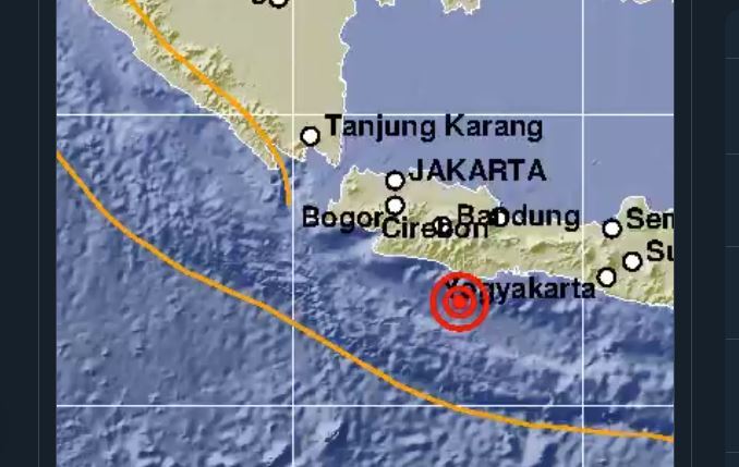
An earthquake measuring 5.9 magnitude rocked Pangandaran Regency, West Java, on Sunday 25th October at 7:56am Western Indonesia Time.
Based on a report from the Meteorology, Climatology and Geophysics Agency (BMKG), the earthquake strength was updated to be 5.6 magnitude, with no potential for a tsunami.
Information on the earthquake was uploaded by BMKG’s official Twitter account, @infoBMKG. From their analysis, the earthquake that occurred was shallow, with a depth of 10km with a location of 8.22 LS, 107.87 East Longitude or 90km from Pangandaran Regency.
Head of the BMKG Earthquake and Tsunami Mitigation Division, Daryono said that there were 17 areas that felt shocks due to this earthquake.
Here are the details of the 17 regions:
MMI III-IV Intensity:
- Sukabumi
- Tasikmalaya
- Pangandaran
MMI III Intensity:
- Kuningan
- Garut
- Cilacap
II-III MMI Intensity:
- Bandung Regency
- Kebumen
- Kutoarjo
- Banyumas
- Banjarnegara
- Kulonprogo
- Bantul
- Gunung Kidul
- Yogyakarta
II-III MMI Intensity:
- Bandung City
- Tegal
Intensity II MMI means that the earthquake was felt by several people and light, hanging objects hanging were shaking. Meanwhile, MMI III intensity means that the vibration was strongly felt in a house.
The intensity of IV MMI means that earthquake vibrations were felt by many people inside and outdoors, causing pottery to break as well as rattling windows, doors, and walls.
Source: Kompas