


Since the dawn of farming, agricultural inputs have been farmers’ helpers in securing lavish harvests.
Over time, seeds, pesticides, and fertilisers have evolved alongside scientific discoveries and technological breakthroughs to deliver more efficiency. However, the agri-input journey has been a winding path. In the 20th century, the then-new agrochemicals enabled the “green revolution,” turbo-boosting crop production and lifting developing countries from acute food crises. Yet, another side to the story unveiled the toll their widespread and wasteful use had taken on the environment and human health.
This spurred the agri-input industry to seek more sustainable, greener solutions driven by state-of-the-art technologies. Crop classification using remote sensing has emerged as one of the enabling tools of precision agriculture – a revolutionary farming strategy of tailoring every farmer’s action to the specific needs of crops that helps reduce waste, improve productivity, and enhance sustainability. Let’s explore how satellite remote sensing and crop classification push agri-input businesses toward reaping more enormous profits without compromising ecosystems.
The era of Precision Agriculture
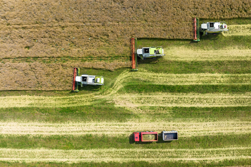
Croplands inherently vary in soil type, crop type, topography, climate, and other factors affecting plant growth and productivity. The main principle of precision agriculture is responding to this variability by making data-driven crop management decisions. By merging rich farm-related data from remote and on-site sensors with GPS and specialised software, this game-changing approach helps farmers glean insights into the current state of their crops and their most vital needs.
Remote sensing, particularly satellite-based one, provides a wealth of information about crops and fields, proving especially valuable in monitoring large and hard-to-reach agricultural lands. Through the use of specific vegetation indices and other methods used to derive vegetation insights, farmers can oversee every stage of crop growth to detect pests and diseases, water and drought stresses, and nutrient deficiencies for timely and proactive interventions.
The most common precision agriculture technique – variable rate technology (VRT) – is focused on optimising input use. It uses data on soil type, moisture, harvest history, and other data points to break fields into zones and calculate the precise quantity of inputs required for optimal crop growth in each zone, down to square centimeters of land, preventing under- or overapplication. The output is a variable-rate application (VRA) map that can be uploaded to seeders, fertilizers, or center-pivot irrigation systems for tailored sowing, fertilisation, fertigation, and irrigation. Agri-input businesses are leveraging VRT not only to better tailor their products to different crop types, climates, and soil conditions but also to help their clients enhance crop management through value-added services.
Why crop type mapping matters
Crop mapping is vital to the food security of entire countries, providing information for planning and managing food production amidst such pressing challenges of our time as climate change, rising global population, and growing food demand.
With national-scale crop type maps, agricultural stakeholders both in top-producing countries and developing ones can estimate and predict the rate of agricultural production and its output to devise economically and environmentally sustainable strategies across the food chain. To do so, they need accurate input crop data spanning the whole country (or state) over multiple years.
For decades, satellites have provided consistent land cover observations at spatial and temporal scales, proving invaluable for precisely identifying crops and crop sequences. Utilising this remotely sensed data not only empowers more efficient agricultural monitoring and enhanced farm productivity (and profitability) but also contributes to achieving the UN’s Sustainable Development goals. Satellite-derived crop type maps give insight into crop rotation and diversification history, enabling the assessment of cropland use intensity, which, if high, may cause soil degradation, yield decline, and reduced biodiversity.
Classifying crops with remotely sensed data
Traditional resource-intensive survey methods are increasingly replaced or combined with remote sensing technology to improve crop type mapping. The sophisticated sensors aboard satellites capture reflected energy at various wavelengths within the spectrum, many of which are invisible to the human eye. Two different types of crops have their own unique spectral signature, which allows the classification of crops based on satellite imagery.
IT companies operating at the intersection of Space tech and Agri tech offer crop classification services at any scale, from countrywide crop type mosaics down to a tiny smallholder farm. They build highly detailed and accurate crop maps by feeding a combination of optical and radar satellite data into their custom-developed and trained neural networks.
Such advanced classification of field crops powers a wide range of use cases, including taking inventory of huge croplands and estimating yields, implementing more sustainable land management, increasing the accuracy of insurance claim validation, and maintaining crop rotation records at scale.
The perk for agricultural input companies
Keeping pace with the digital agricultural revolution and implementing new techniques and data sources, such as crop type maps, is not all roses. However, the many benefits of these innovations outweigh the investment risks, training efforts, and the fear of stepping into the unknown. Let’s explore how agri-input businesses can leverage crop classification in more detail.
Customized product offerings
Knowing the exact types of crops grown in the region is key to customising seeds, fertilisers, pesticides, and any other agri-inputs meant for these crops. This will make products more efficient and beneficial for growers’ yields.
Efficient resource allocation
Through crop classification and regular satellite monitoring of identified crops’ health, agri-input businesses can get more flexible with product allocation, directing crop-specific products where they are most needed.
Data-driven marketing and sales strategies
Knowledge of crop types powers the understanding of agricultural market trends, leading to more accurate forecasting of regional product demand and, as a result, allows optimising marketing strategies and sales planning.
Sustainability at the core
Agri-input producers can develop green agrochemicals to reduce the environmental footprint of fertilisers, pesticides, and herbicides. Moreover, by better tailoring inputs to specific types of crops, they promote sustainable farming methods that prevent fertiliser runoff, intensive water use, and other harmful effects of agriculture.
Hurdles in the way of technology uptake
The opportunities associated with using remote sensing data and precision agriculture technologies hold great promise for the farming inputs industry, but the barriers are also plentiful. Tech innovations require tangible investments, and it may take a long time to see the return; besides, their integration into existing business operations always involves unique expertise, which can be either outsourced or provided in-house through additional training.
Last but not least, data utilisation raises security and privacy concerns that must be addressed properly. On the bright side, technology is becoming more ubiquitous, reducing these barriers and facilitating new innovative applications.
Modern agri-input businesses are becoming more tech-savvy, envisioning the many opportunities offered by advanced solutions like crop classification using remote sensing and going for them. By harnessing remote sensing data to draw precise and timely insights about crop types at various spatial and temporal scales, companies take their product development, marketing, and sales to the next level through tailored products perfect for sustainably boosting crop yields. As global technology uptake grows, the agri-input sector and the entire food production industry transform to enhance individual profitability and global food security.