


Talk about the Sunda Strait and two things crop up in our minds – Krakatoa Island and earthquakes. A basic geographic knowledge will suffice to get these etched as omnipresent thoughts.
Both are capable of evoking explosively onomatopoeic terms and thus, are hard to forget. The Strait that squeezes its waters between the two most significant islands in the Indonesian archipelago is often dreaded by lay tourists, savored by adventurers, and absorbed by fishermen for whom it is life. The thunder that is said to have reached as far away as Darwin in Australia and Madagascar is still a curious case study for many vulcanologists. That was in 1883, when Krakatoa erupted in its full majesty, sweeping across the coastal towns of Java and Sumatra, killing more than 36,000 people that is proportionate to more than a million in modern times. At that time, the Krakatoa archipelago consisted of three islands – Verlatan (known as Sertung now), Lang (known as Rakata Kecil now) and Rakata, which is known as Krakatoa Island these days. Krakatoa is a caldera, part of Rakata island. Anak Krakatoa, which has taken the place of its mother, caused a tsunami in 2018, triggering goosebumpy moments among many who had not left history behind.
In 2006, I hopped on to a fisherman’s boat with a friend and we set sail to the historic location from the port of Labuan. The wooden boat had just enough width for two adults to walk side by side, but long enough to accommodate a small shed which the fishermen used to store things and as a kitchen. They caught tuna on the way, cooked them, and made rice for the four of us. It took nearly five hours to reach the shores of the volcano. We climbed to the summit, trekked around the vegetation to have amazing aerial views of the nearby islands, and got back to the boat. The return was not as smooth as the arrival. Choppy waters tested our constitution; the fishermen were being all but worried. The two asked us to hold on to a pole with the Indonesian flag hoisted on it, watching our apprehensive miens. We gawked enviously at the speedboats overtaking us in apparent ease and comfort.
On some eventful afternoons, when people are forced out of their offices in skyscrapers in and around Jakarta, it is most likely caused by an undersea quake with its source somewhere in the Sunda Strait. Within minutes, panicky professionals and residents locate the epicenter on the BMKG website. Any tremor of the intensity of four and above in the Strait can jolt life in the capital city. The Strait sits at a location where the Indo-Australian and the Eurasian tectonic plates converge, leading to regular seismic activities.
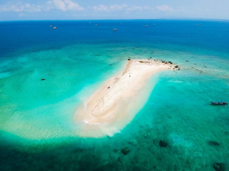
One of the eye-catching features on the Strait is small islands and sandbanks some of which have been developed as tourist spots. Usually done as day trips or weekend getaways, Pulau Umang and Pulau Sangiang draw local visitors in large numbers throughout the year. During my latest cruise on the Strait, I did an island-hopping that took me to Pulau Badul, now a mere sandbank after the 2018 tsunami rooted out a small cluster of trees on its northern tip. The islet is part of the Ujung Kulon National Park in the western end of the Sunda Strait. Tourists embarking on journeys from the Pandeglang area in Banten usually hop on to three islands that can be done in a day – Pulau Badul, Pulau Manggir and Pulau Oar. All three islands had to bear the brunt of the giant waves in December 2018 before the coastal areas in Banten were smashed.
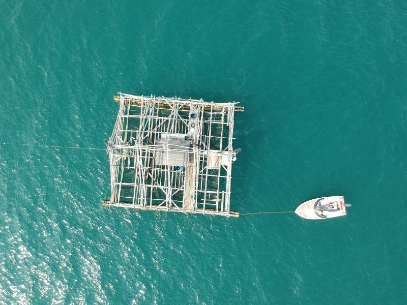
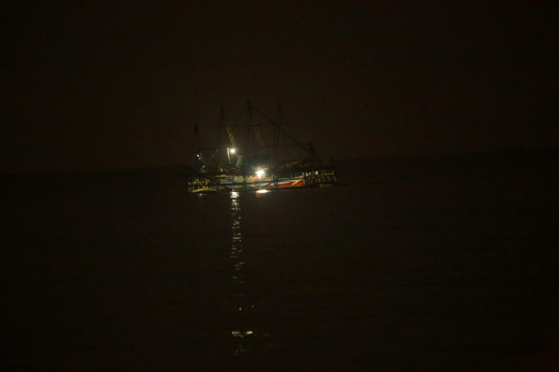
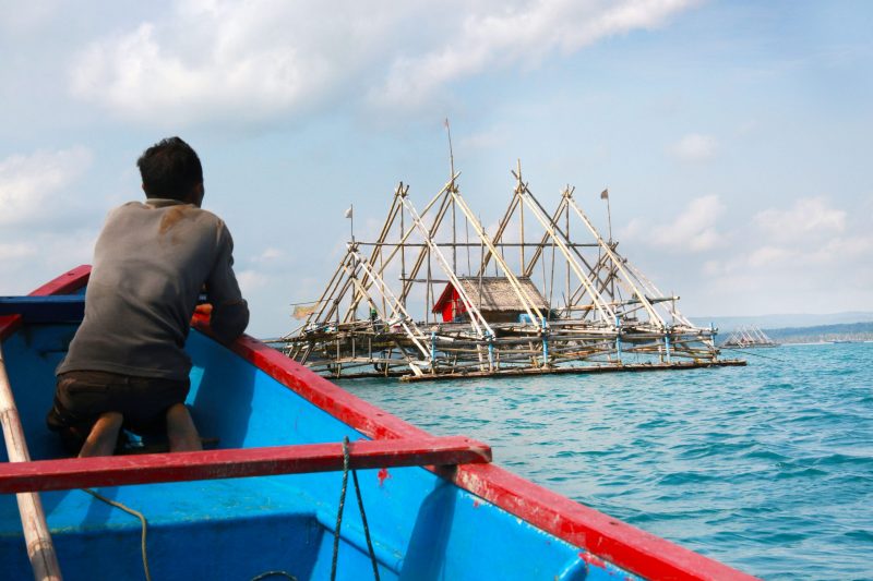
With all the danger still persistent, the fishermen are still unyielding and are part and parcel of nature. The Bagan is one of the floating examples of this life-goes-on spirit on murky waters, refilling lesser souls with hope and courage. Shaped like a rising flotilla on the sea, the Bagan are bamboo-made floating fishing huts found all over the Sunda Strait. Once the bamboo poles are tied and assembled on Banten’s shores, they are dragged on to specific catch points in the sea by fishing boats. Fishing is usually done at night, using bright lights. The lights attract the fish to the Bagan, and the nets lowered from the bottom of the structure are raised to bring ashore the catch. The fishermen have a small shelter in the middle to escape from rain or to rest, made of discarded pieces of aluminium or plastic.
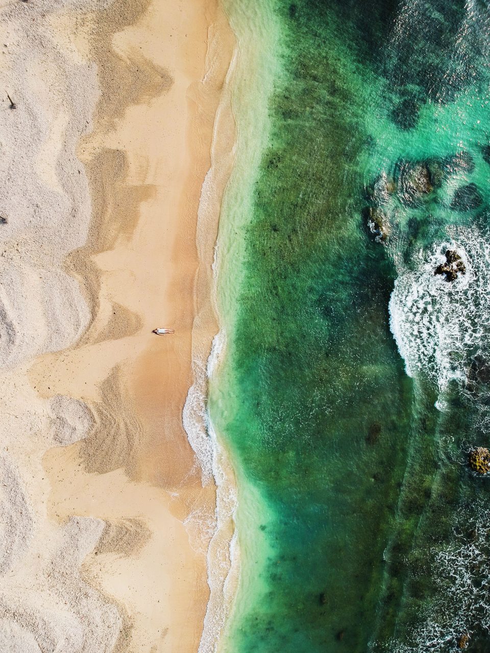
My first road trip after the PSBB was lifted in Banten and beaches were reopened was along with the western-most tips of Banten. The beaches on Tanjung Lesung (Special Economic Zone) and Sumur (the last township before you get into the jungles of Ujung Kulon National Park) were absolutely empty. Every beach has scattered deposits of seashells and coral stones to tell the visitors the story of the deadly tsunami. Some resorts still have half-demolished structures probably preserved for memory or awaiting future renovation. The turquoise-blue water nevertheless is one of the best you can find in close proximity to Jakarta.