


Environmental experts, along with the Indonesian Ministry of Environment, have analysed the likely cause of what was the most devastating flood to hit Bali in years.
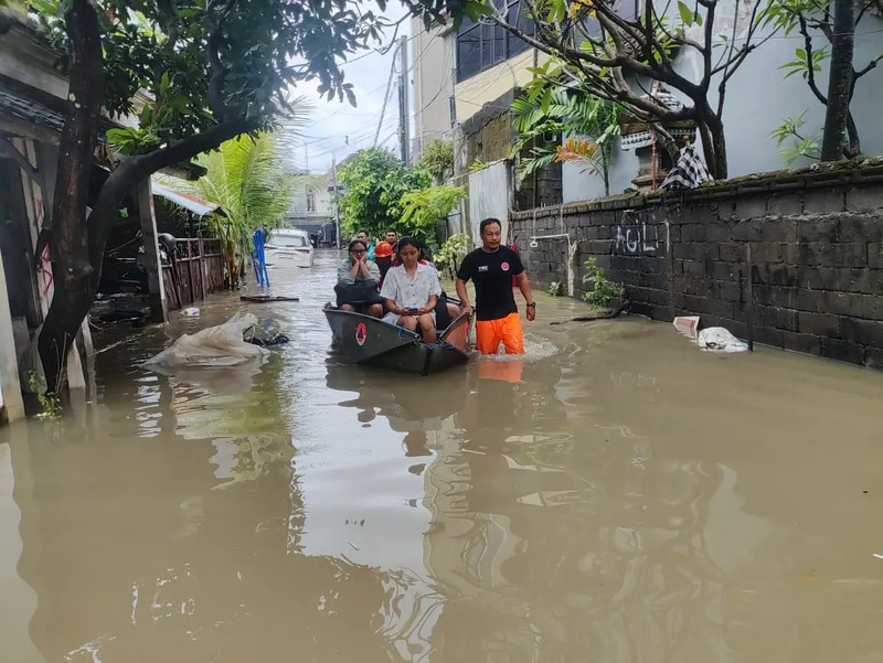
Bali was struck by a devastating flash flood on Wednesday, the 10th of September. According to data from the National Disaster Management Agency (Badan Nasional Penanggulangan Bencana, or BNPB), the disaster claimed at least 17 lives across Denpasar, Badung, Gianyar, and Jembrana, with thousands of residents displaced and material losses amounting to billions of rupiah.
Environmental experts and activists have since highlighted one major factor that may have exacerbated the disaster: land conversion. The transformation of green areas such as rice paddies, forests, and water catchment zones into permanent structures has dramatically altered Bali’s landscape, reducing the island’s ability to absorb rainwater and increasing the risk of flooding.
The Executive Director of Wahana Lingkungan Hidup Indonesia (WALHI) Bali, Made Krisna Dinata, stated that the flooding was caused by land conversion, poor spatial planning, and inadequate waste management.
“Especially the conversion of agricultural land into buildings, which was the initial trigger for the Bali flood disaster,” said Dinata, as quoted from the press on Monday, 15th of September.
A primary factor contributing to the floods is the loss of natural water absorption. Green areas such as rice fields and forests act as natural sponges, absorbing rainwater, reducing runoff into rivers, and preventing overflow. Furthermore, data from the Indonesian Ministry of Environment shows a decrease in rice field area of up to 6% in several regencies, including Denpasar (784.67 hectares lost) and Tabanan (2,676.61 hectares lost).
Additionally, poor spatial planning in Bali—such as developments encroaching on riverbanks and coastal zones, along with megaprojects like the Gilimanuk-Mengwi Toll Road—has further worsened the situation. This toll road project threatens 480.54 hectares of rice fields and 98 subak (traditional irrigation community) points, which, if lost, would destroy the natural hydrological system.
“This land conversion, combined with climate change, makes Bali vulnerable to flooding,” added Dinata.
Meanwhile, Environment Minister Hanif Faisol Nurrofiq has recently remarked that he is willing to consider a development moratorium in Bali, as he believes the recent flooding has made such a measure unavoidable.
“In my opinion, a moratorium is mandatory. Because the landscape is very diverse, and the population is high. Serious measures must be taken,” remarked Nurrofiq previously on Saturday, 13th of September.