


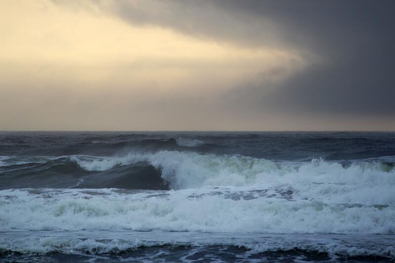
The Meteorology, Climatology, and Geophysics Agency (BMKG) has issued a warning for high waves potentially reaching six metres in the South Indian Ocean around Banten and Central Java from Wednesday 28th December to Thursday 29th December 2022.
According to BMKG, the wind pattern in the northern part of Indonesia is moving from west to north with wind speeds ranging from 8 to 20 knots, whilst in the southern area, the wind is moving from southwest to northwest with speeds ranging from 5 to 30 knots.
The highest wind speeds have been recorded in the North Natuna Sea, Java Sea, southern waters of Java, Flores Sea, Banda Sea, and in the waters of the Sermata Islands-Tanimbar Islands and the Arafura Sea.
There is a possibility that high waves with lower wave heights will appear in other parts of Indonesian waters, as well.
BMKG predicts that the volume of the waves will potentially increase as high as 1.25 to 2.5 metres in:
- The western waters of the Aceh-Mentawai Islands
- The West Indian Ocean of Aceh-Mentawai Islands
- Waters of the Anambas-Natuna Islands
- Natuna Sea
- Waters of the Bintan-Lingga Islands
- The Karimata Strait
- Bangka Belitung waters
- The Gelasa Strait
- Lampung Bay
- The northern part of the Sunda Strait
- The western part of the Java Sea
- The northern waters of West Java
- The southern waters of Kalimantan
- The western waters of South Sulawesi
- The waters of the Sabalana-Selayar Islands.
The same phenomenon also has the potential to take place in:
- The Bali-Sumbawa Sea
- The northern part of the Lombok Strait
- The northern waters of Sumbawa-Flores
- The southern part of Bone Bay
- The waters of Baubau-Wakatobi Islands
- The southern waters of Sumba Island
- The Sawu Sea
- The Ombai Strait
- The western part of the Sumba Strait
- The southern part of the Sape Strait
- Kupang-Rotte Islands waters
- The central and eastern Sulawesi Sea
- The waters of the Sangihe Islands and southern Talaud Islands
- The waters of the Sitaro Islands
- Bitung waters
- Maluku Sea
- Halmahera waters and Halmahera Sea
- The waters of Buru Island-Ambon Island-Seram Island
- The northern waters of the Kai Islands-Aru Islands
- Fakfak-Kaimana-Agats-Yos waters of Sudarso
- The northern waters of West Papua-Papua
- The North Pacific Ocean of West Papua-Papua
A higher volume of waves of 2.5 to 4 metres has the potential to occur in:
- The North Natuna Sea
- The waters of Bengkulu-Western Lampung
- The West Indian Ocean of Bengkulu-Lampung
- Western and southern Sunda Straits
- Southern Banten-Sumbawa waters,
- Bali Strait – Lombok-Alas south
- The South Indian Ocean of East Java-East Nusa Tenggara
- The central and eastern Java Sea
- The northern waters of Central Java and East Java
- The southern Makassar Strait
- The Flores Sea
- The Banda Sea
- The waters of the Sermata-Tanimbar Islands
- The southern waters of Kai-Aru Islands
- The western part of the Arafura Sea
- The northern waters of Kep Talaud
- The North Pacific Ocean of Halmahera
BMKG warned people who live in coastal areas to be more aware and to stay safe.
“We remind the people who live and work around the coastal areas potentially affected by the high waves to be more aware,” wrote the BMKG.